Maps
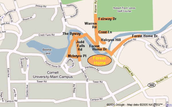
Map of Forest Home
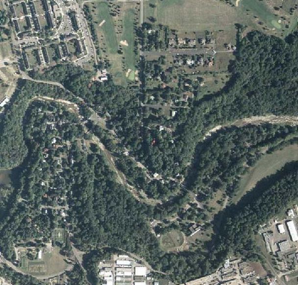
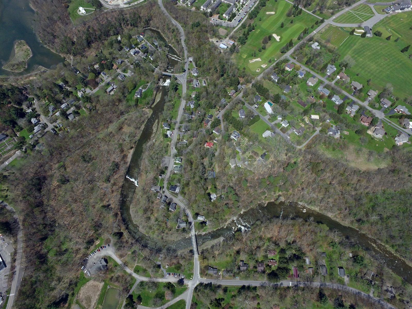
Aerial photographs
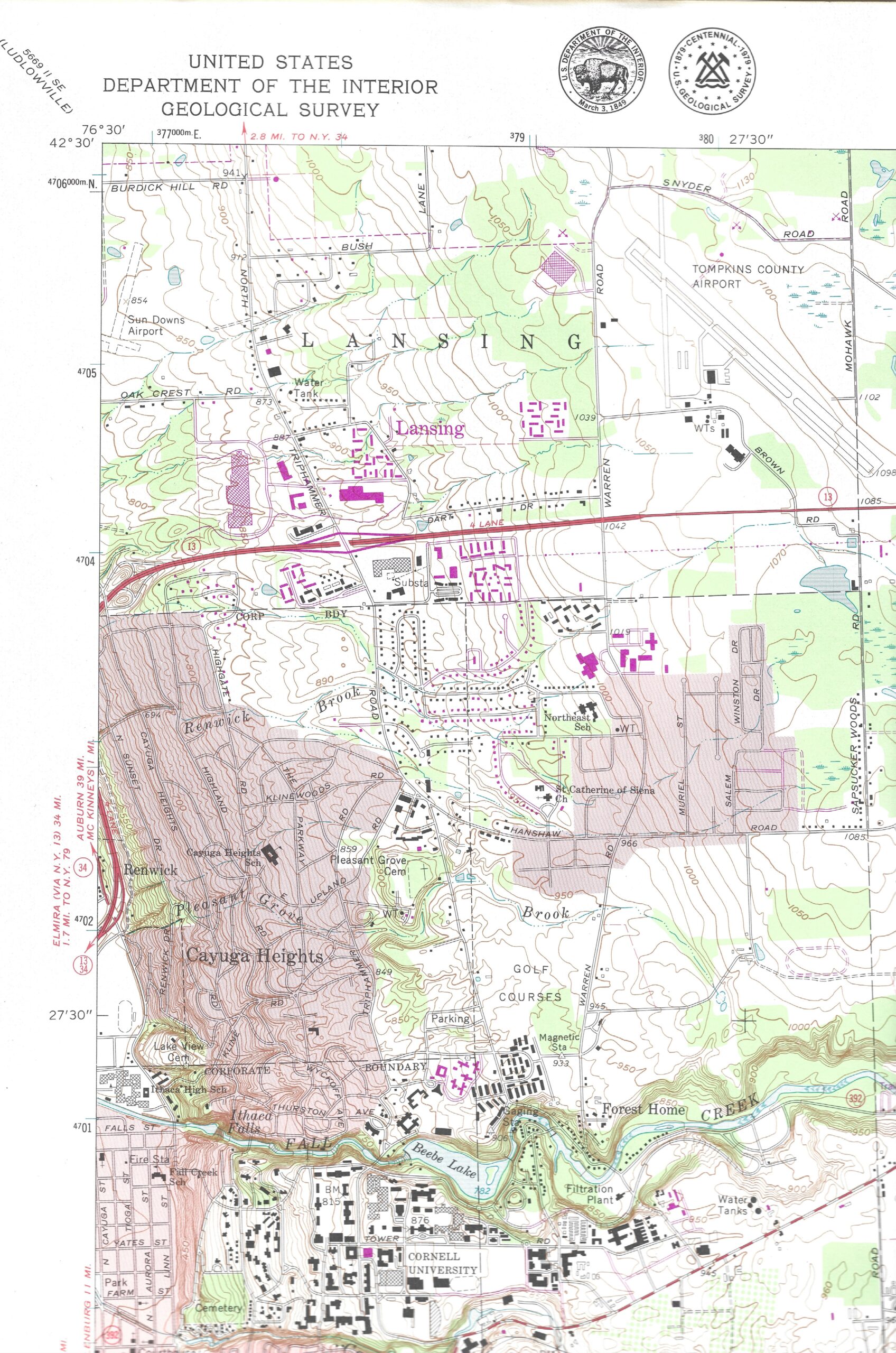
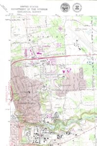
Forest Home in USGS Topographical Map
[Note: The map is based on topography captured in 1944, updated and field-checked in 1968/69. Modifications in purple are based on aerial photographs and other sources from 1976, but were not field-checked.]
This map is the most recent published USGS Topo map that shows building structures.
Link to higher resolution view
Town of Ithaca 2023 Tax Parcel Map for Forest Home
Link to higher resolution view
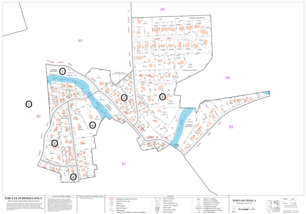
Tompkins County Department of Assessment maintains maps of tax parcels for all municipalities in the county. See https://www.tompkinscountyny.gov/assessment/taxmaps
The source for this tax map is the file of maps for the Town of Ithaca. See https://www.tompkinscountyny.gov/files2/assessment/TaxMaps/2023/Ithaca.pdf
Discover GIS Data NY (focused on Forest Home)
Discover GIS Data NY is a map-like resource that lets you look at orthophoto imagery from 2023 and several earlier years, back to 1994. There is a time-slider in the tool kit that lets you see different years. The icon with screwdriver and spanner/wrench reveals the tools; the time-slider icon is a clock face.